ComNav Showcases Latest Deformation Monitoring Solutions in Cameroon
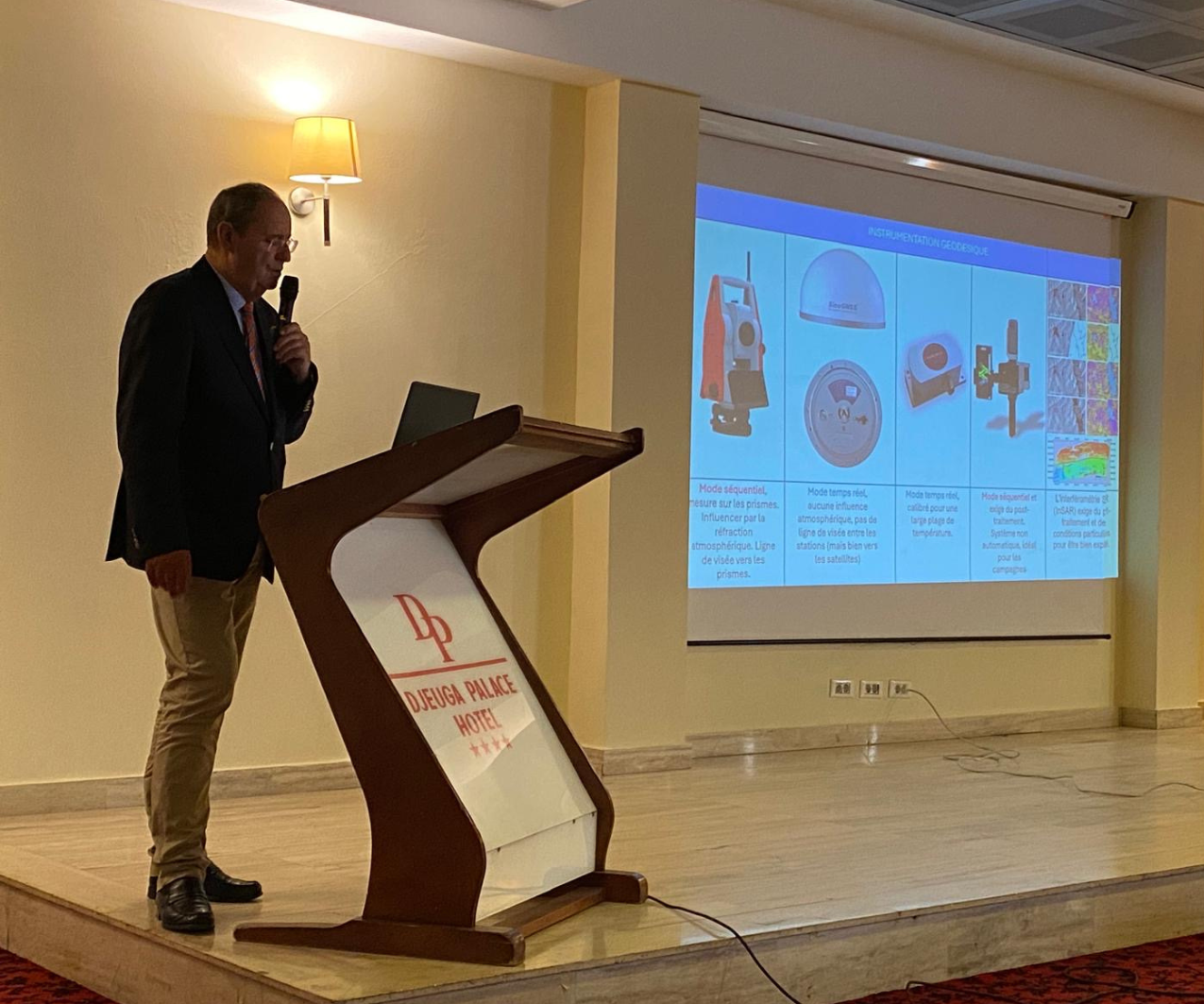
On June 23, 2024, Joss K. Wamba, the founder of NODAL Géo Solutions, organized a seminar on deformation monitoring in Yaoundé, Cameroon. Prof. Joel van Cranenbroeck, the Managing Director of CGEOS - CREATIVE GEOSENSING SRL and ComNav Technology LTD. (ComNav)'s exclusive partner in Belgium, was invited to the seminar. He presented and introduced ComNav's advanced monitoring solutions and shared his case studies. These technologies not only highlight the latest advancements in the field of deformation monitoring but also offer new possibilities for future emergency response and disaster management.
 |  |
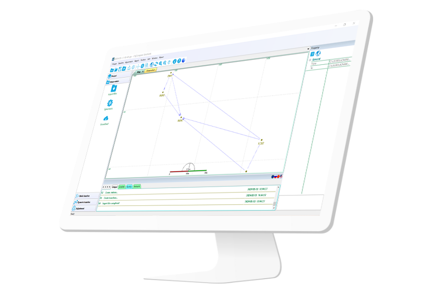
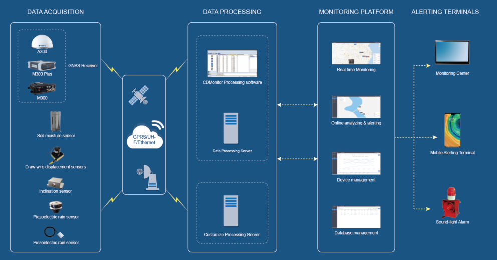
Monitoring always plays a crucial role in ensuring the convenience and safety of people, including applications like geological disaster monitoring and man-made structure monitoring. The advanced SinoGNSS monitoring system comprises a data acquisition system, data transmission system, data processing server, monitoring platform, and alerting terminals, providing users with an automated monitoring solution featuring a complete workflow. With millimeter-level accuracy, users can trust in its reliability. Powered by CDMonitor software, it offers real-time, 24/7 monitoring and supports remote management. Its flexible communication and compatibility with multiple sensors make it adaptable to various environments.
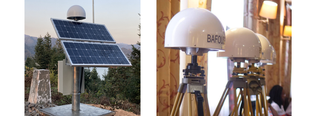
During the seminar, the ComNav A300 GNSS Receiver was prominently showcased, highlighting its advanced features and capabilities. It integrated GNSS module, GNSS antenna and communication module in one compact receiver, especially designed for monitoring solutions. Reliable and convenient user experience is ensured via compact design, high-precision positioning and flexible transmission of A300. As a universal GNSS receiver, A300 is compatible with multiple sensors in facing of different kinds of monitoring tasks, which is one of the best choices for your monitoring solutions.
Apart from A300, we also provide other GNSS receiver for the deformation monitoring.
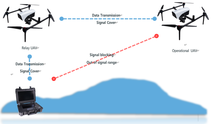
Among the showcased products, the E300 stands out as a real-time 3D reconstruction system for high-efficiency disaster relief operations. This system can be operated by a single person and provides real-time 3D reconstruction of disaster-stricken areas, delivering accurate and detailed 3D models for rescue operations. The innovative use of relay UAVs extends the operational range and ensures uninterrupted communication and data transmission, even in challenging environments. This technology not only enhances rescue efficiency but also ensures the safety of rescuers within the disaster zone.
What’s more, the LS300 Laser Scanner uses SLAM technology, which allows for precise 3D map generation while in motion, also with frequent data update, ideal for complex and changing environments like post-disaster scenes. Importantly, it can navigate and scan the interiors of buildings, creating detailed 3D models of internal structures. This is useful for assessing damage in disaster-affected buildings and determining safety for entry. Detecting and documenting details such as cracks and deformations in structures helps engineers in evaluating structural stability.
Through these, SLAM laser scanners significantly enhance the efficiency and accuracy of deformation monitoring and rescue operations, enabling rescue teams to respond swiftly and make informed decisions in complex and dynamic environments, ultimately reducing disaster-related losses and casualties.

The P6H Handheld is an advanced, rugged device tailored for Geographic Information System (GIS) professionals. As a compact and portable GIS solution, it seamlessly integrates into the hands of field experts.
It can be used in the pre-disaster preparedness, to access risks and and provide early warnings. During disasters, it can play a crucial role in the resource allocation. Rescue command centers can use GIS to view the locations and statuses of various rescue resources in real-time, optimizing dispatch decisions and improving response times. Also, it calculates the best routes for rescue teams and supplies, avoiding damaged roads and bridges, ensuring quick access to affected areas. In the post-disaster recovering, GIS can help with loss assessment and recovery planning.

ComNav is dedicated to providing advanced monitoring solutions for disaster emergency response, leveraging its technical prowess and innovative capabilities to offer more possibilities for future deformation management and emergency response. If you are interested in the solutions provided by ComNav, please contact us.
About ComNav Technology
ComNav Technology develops and manufactures GNSS OEM boards and receivers for high precision positioning demanded applications. Its technology already been used in a wide range of applications such as surveying, construction, machine control, agriculture, intelligent transportation, precise timing, deformation monitoring, unmanned system. With a team dedicated for the GNSS technology, ComNav Technology is trying its best to supply reliable and competitive products to worldwide customers. ComNav Technology has been listed on the Shanghai Stock Exchange (Science and Technology Board), securities :ComNav Technology (Compass Navigation), Stock code: 688592.
About SinoGNSS®
SinoGNSS® is the official trademark of ComNav Technology Ltd., registered in People's Republic of China, EU, USA and Canada. All other trademarks are the property of their respective owners.